 Incorporated Research Institutions for Seismology
Incorporated Research Institutions for Seismology
Incorporated Research Institutions for Seismology
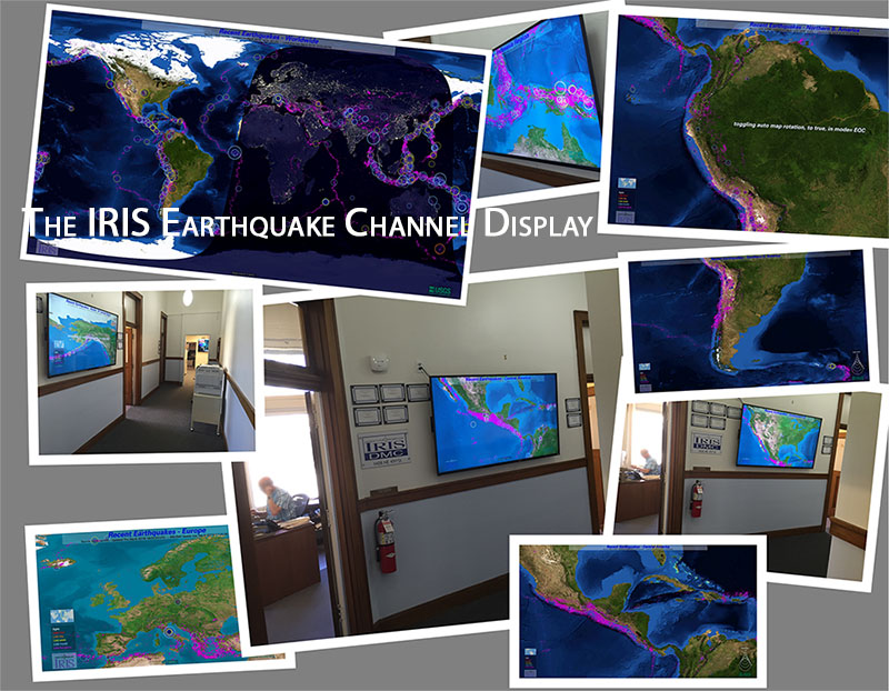
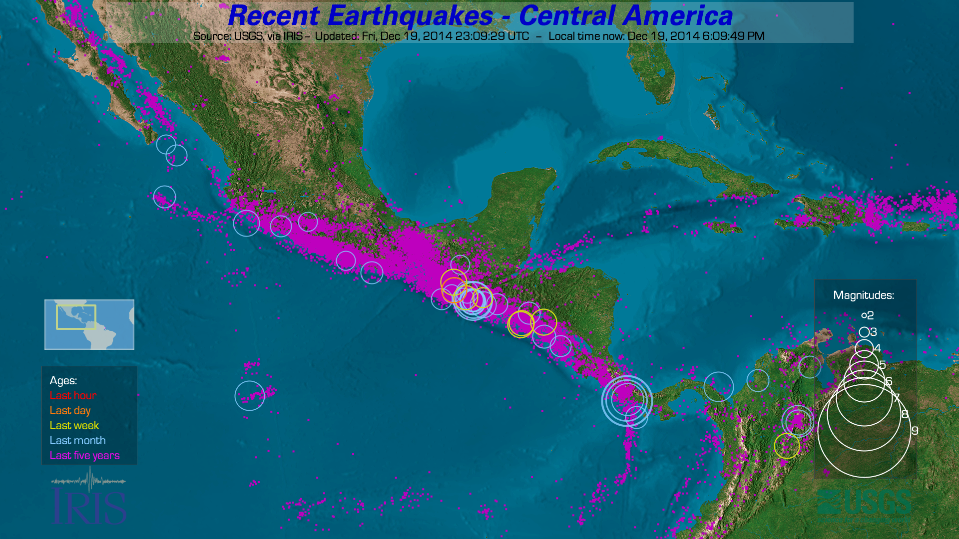
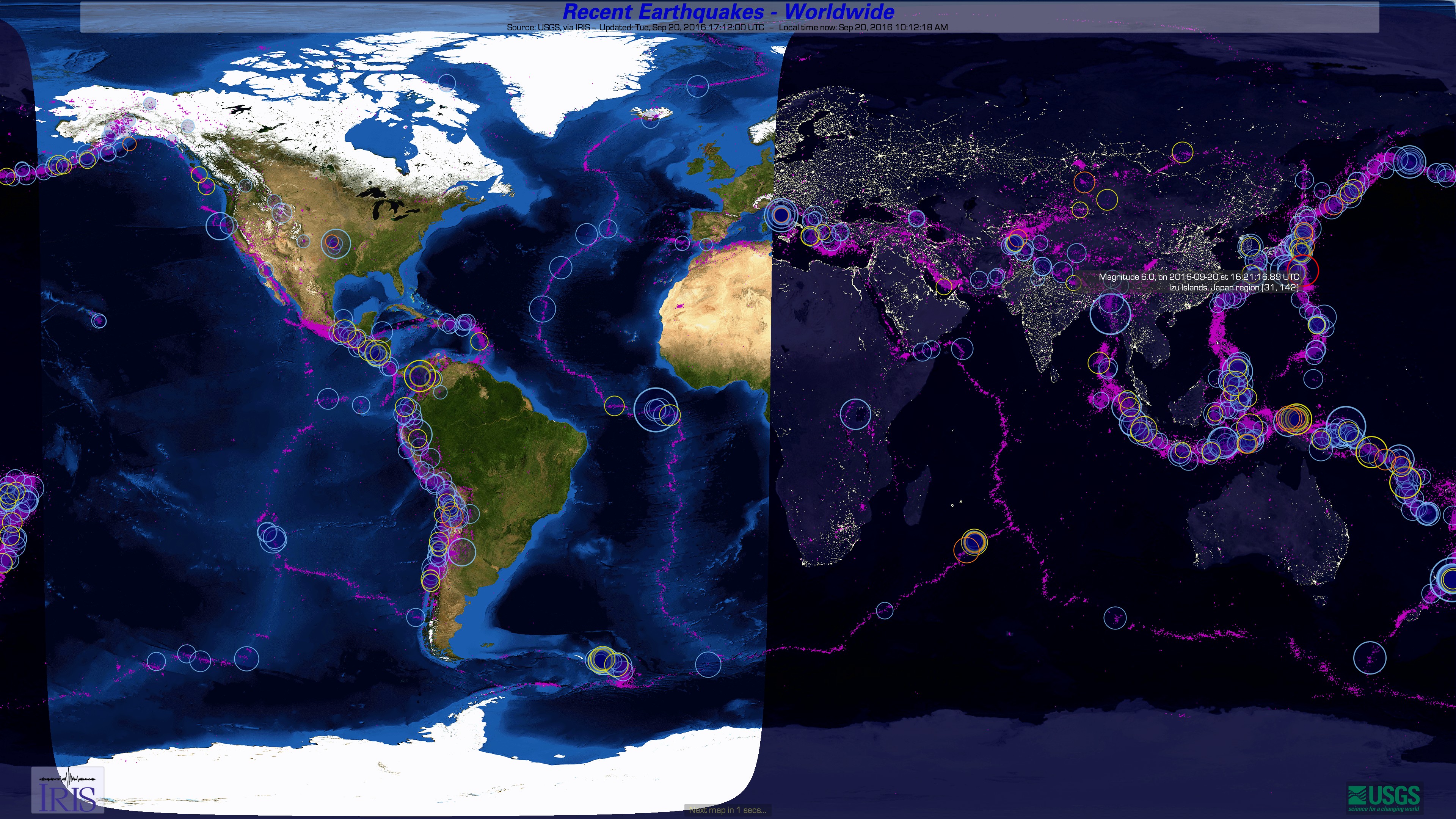
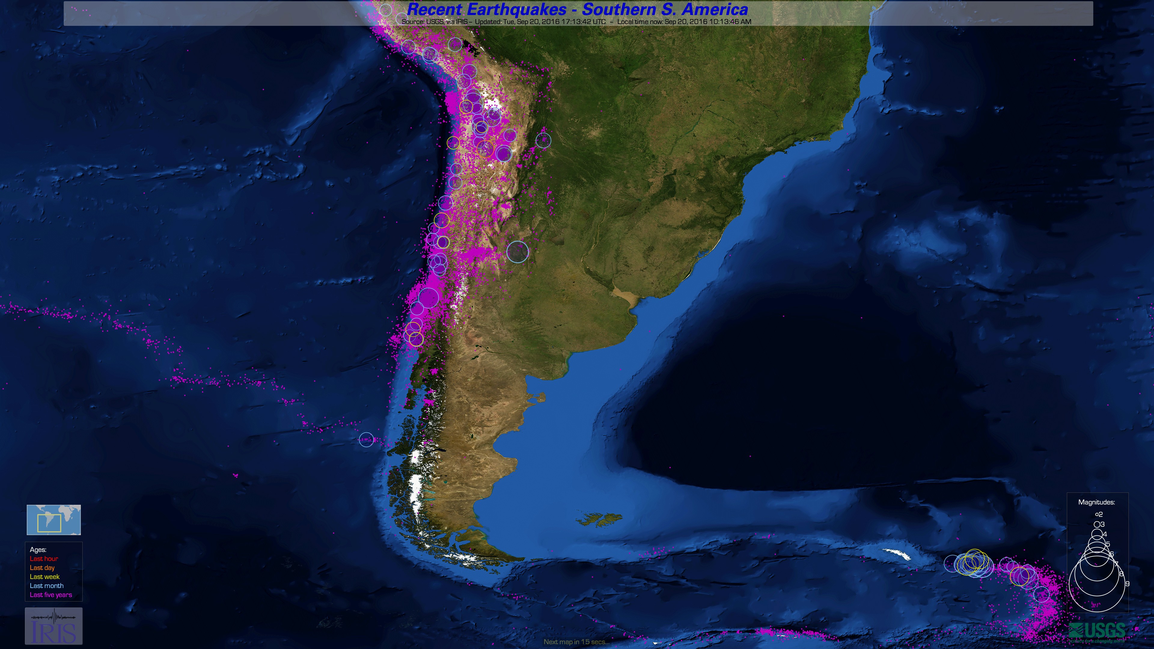
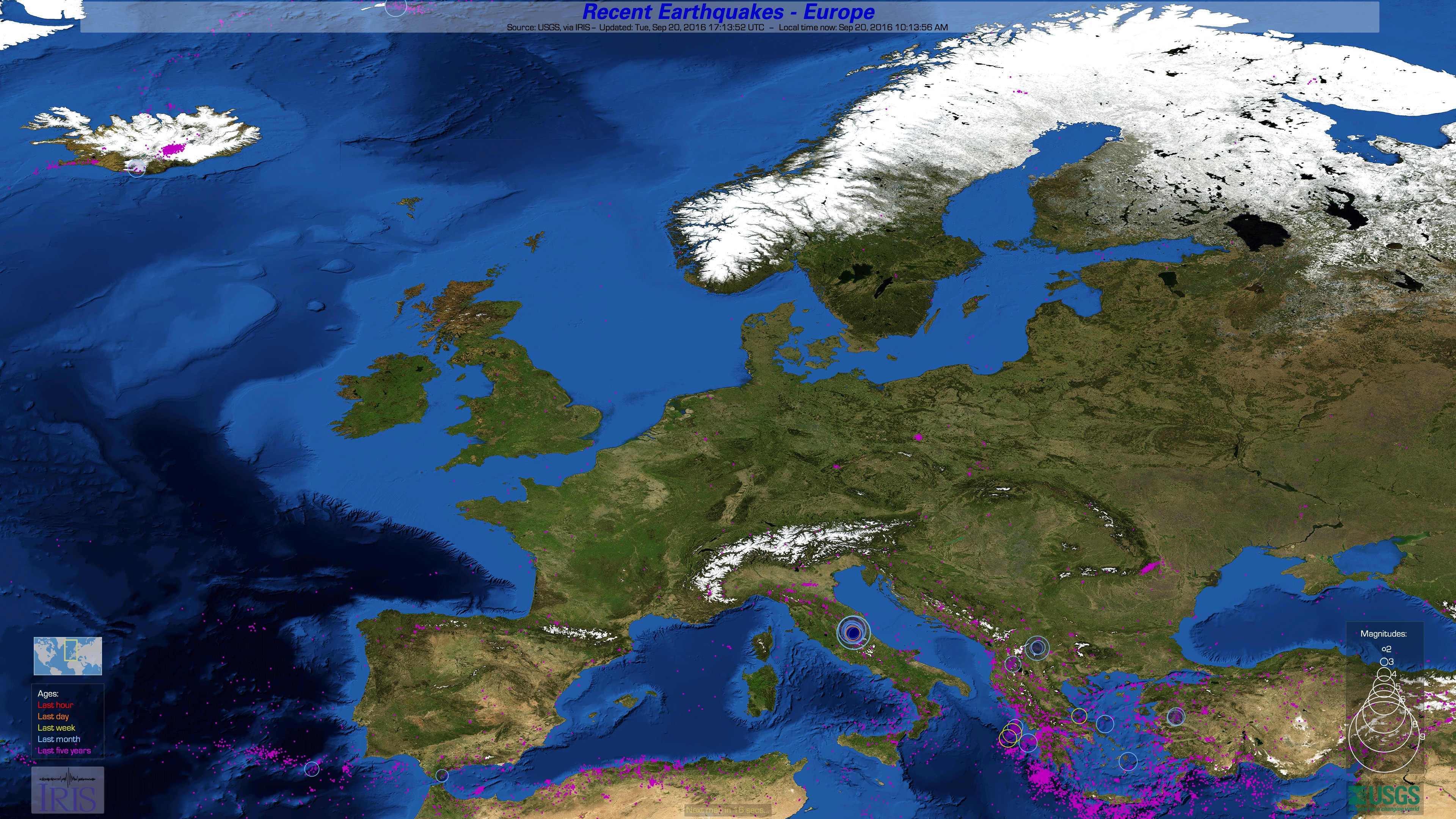
The IRIS Earthquake Channel is a free application that shows earthquakes on high resolution maps, suitable for display in a museum, lobby, visitor center or school setting.
The earthquakes are up-to-date, customizable, and quite impressive on a large-screen display with beautiful, high-resolution satellite imagery.
The world and 16 regional maps are included. Users can change various preferences, including the maps shown, their order, time-on-screen and more.
Earthquake updates are every 10 minutes, while the map changes every 30 seconds. The software can run for weeks unattended.
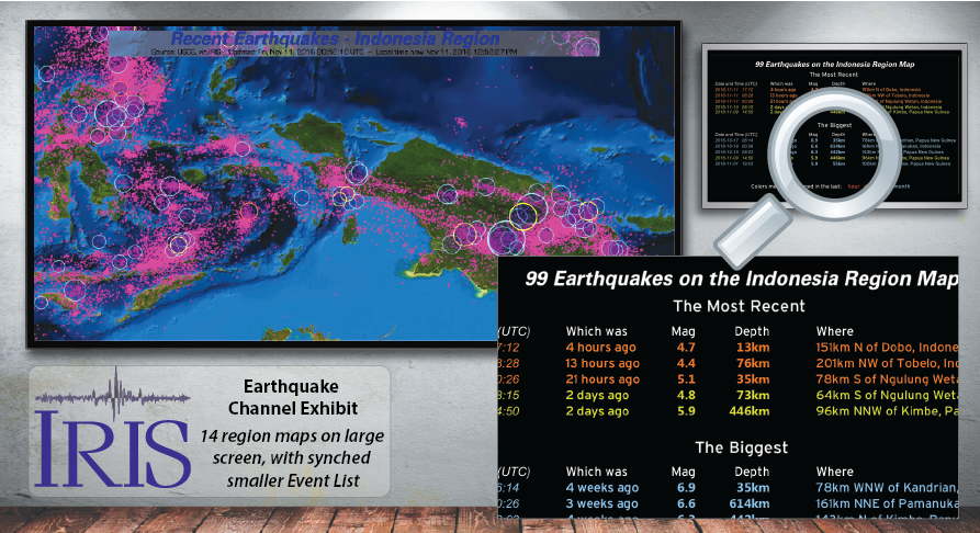
Circle sizes and colors show each earthquake's magnitude and age. Magenta dots are used for historical seismicity to enhance the plate boundaries and regions of high seismicity.
Got a second monitor? EventList (included) is a companion application which shows a textual list of the significant earthquakes currently shown on the main monitor.
Earthquake Channel is a MacOS application. (Windows and Linux downloads offered, but not fully-supported)
The maps are sized for either of two monitor resolutions:
Full HD (2K) at 1920x1080 - is great for screens up to about 50 inches, and
Ultra HD (4K) at 3840x2160 - looks amazing on screen sizes of 50 inches and beyond.
Download Earthquake Channel Question? Email us here.
Version 2.5 (14 Nov 2017) with various fixes and improvements, notably for the latest MacOS 10.13 High Sierra.
EventList is the companion app for a second monitor, which shows the significant earthquakes on the current map.
It uses plain-English phrases like "25 minutes ago" or "2 weeks ago" to make dates and time zones easy-to-deal-with:
Example configuration
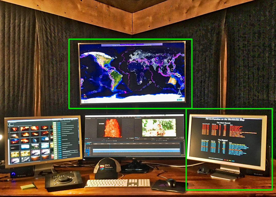
The cost of an Earthquake Channel display running on a massive 65" screen can be under US$1400 (as of 5/2017).
Shown running at Global Net Productions studio, courtesy of M. Lienau, and Honua Studios:
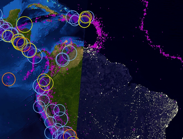
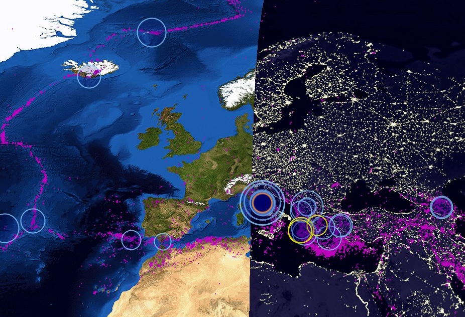
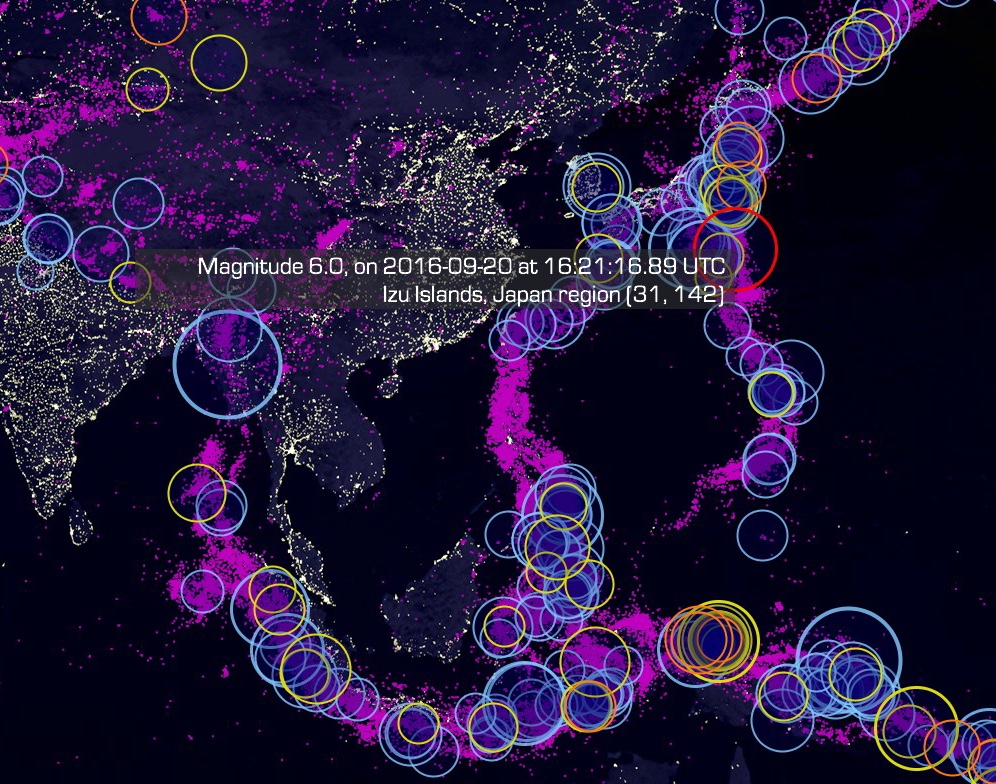
Imagery samples (click to enlarge)
A 2K imagery example:
4K imagery examples:


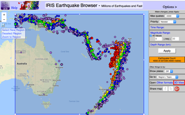
the IRIS Earthquake Browser :
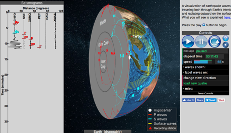
and the Seismic Waves simulator :